|
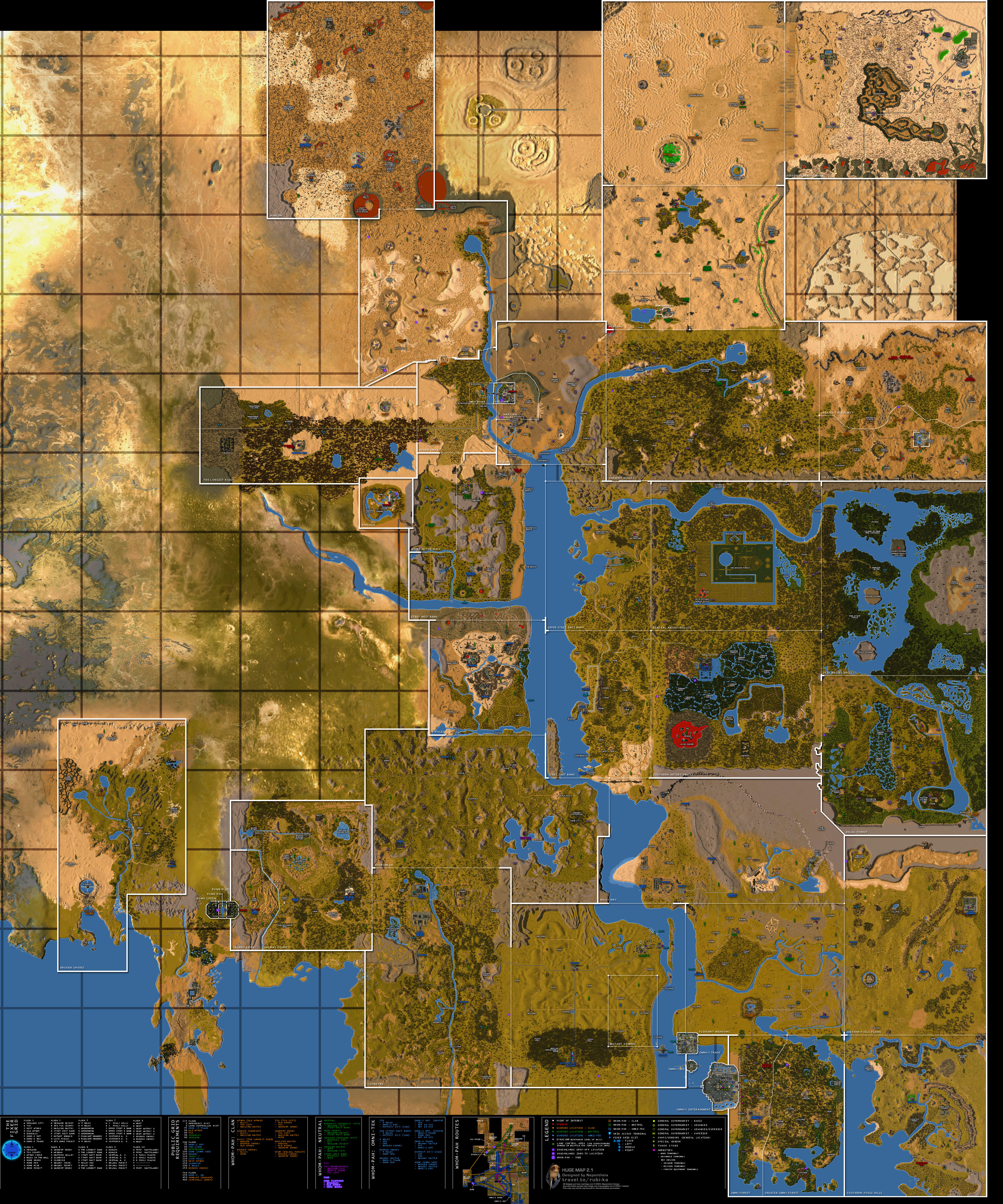
This is a very large map which provides incredible detail of playfield terrain and
structures of Rubi-Ka, and includes: Playfield borders with zone lines Playfield name,
Land Control Areas, Whom-Pah System routes Grid Access Terminal locations, Public
Grid Access requirements, Fixer Grid Exits, Playfield Locations in the Fixer Grid,
Ferry Locations, and Routes, Guarded Locations (outposts, guard posts, etc.),
Startup Backyard, Locations, Carbonrich Rock fields and qualities, Labeled Points of
Interest, Dungeons, DynaCamps, Amenities (bank terminals, insurance terminals,
etc.), Supermarkets, Vendor/shop general locations, Special Vendor locations.
This map is also available as an IN-GAME MAP with supplimental Playfield Help Files
included in the download.
Click on the link below for an:
|
|